Wake to the trimming of palms next door, with Mt. San Bernardino beckoning. Because of the misbehaving car, will head back north today, but not without another walk first -- thrilling details to follow...

first leaving the Browning household,

bidding farewell to Elena and their sporty vehicle,

meeting John for breakfast in downtown Redlands, not at McDuff's (the view north from our old haunt),

but at Briskets

with views east to the San Bernardinos.

So a sedate walk in the heat today from

Mountain Home down to the Yucaipa crossroad,

this concluding the Rim of the World Drive (more Canyon of the World at this point), looking up toward the San Gorgonio highcountry

and Mt. San Bernardino,

and descending where northfacing (left) and southfacing (right) slopes wear decidedly different demeanors,

the former relatively lush, even with some of the Big Cone Douglas Fir having passed on,

the latter sere and rocky.
As yesterday, this is a red-bike-shuttle-hike, parking the car, riding downhill, then walking up and repeating the process after driving further downslope (yes, what some people do for entertainment), but allowing for a leisurely contemplation of the world, many pictures, and ensures that I do walk every step of a personal Pacific Crest route, but not necessarilly double the route (interesting -- to me anyway -- that this same course of action was elected in previous outing on 243, but not on the Marion Mountain Road, where I actually did walk both ways... down and up... in the spirit of a trail).

So I digress, walking further downhill

to swimming locales sheltered by rocky cliffs,

canyon narrows,

the national forest sign,

a mini gallery forest of Sycamores,

and out into the outwash slopes of the Santa Ana River,

the environs becoming more desertic below Morton Peak,

all the way to the Mill Creek Forest Ranger station (with the Crafton Hills / Zanja Peak behind),

and indeed to the San Gabriels (discounting all the irrigated build-ups of human occupation).

There's a touch of central California in the side canyon

sycamores,

yet the clouds build as in the desert for a potential afternoon shower.

Further, back in the car, heading off to local Toyota dealership, where I am assured that the car can be driven home by just keeping hold of the gear shift when in second and fourth (which is what I've pretty much discovered anyway by this point, since have encountered only two more "slippages" since coming off the San Jacintos yesterday), but there is a recommendation that perhaps steep grades should be avoided. Therefore, am heading up 101 (highest pass at Cuesta, north of San Luis Obispo at c. 1500 ft, rather than I-5's Tejon at 4004). Besides, this different return will allow for new pictures. Joy...

including shots of Pomona College (o'er watched by the San Gabriels), and

Claremont Graduate University, so here goes.

Coming into town with the refurbished train station to the south,

there's the old summer-of-1978 home to the west and

Harwood Field and

Wig Beach to the east.

The dorm

room of that spring still nestled,

the front door officiating,

across the street from the art gallery,

next to Harwood and

Mudd-Blaisdell with

Oldenborg beyond.

College Avenue (particularly from Bonita to 7th),

with its iconic sign (sometimes lacking the final "e"), has its

stately homes,

eucalypti,

palms, and

cypress and oaks,

along with Thatcher Music Building, looking smart on the west

north, and

east,

adjacent to Little

and Big Bridges (check those ethnomusicologically significant names of historical import)

with its grand lawn west.

The science center (Heather Tyreman's old haunt)

and the old CGS Music Department

lead the way to Pomona's clock tower

and Honnold-

Mudd Library.

Memorial Park still holds the meaning of life as

we head out of town via where of Indian Hill and Foothill Boulevards meet at the bank temperature clock (so assiduously checked many summers ago on the way to and fro the long-gone Montessouri Academy on

Baseline Road).

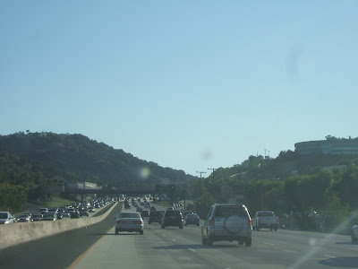
Susan Brown is not home with Moira (but the vegetation looks great), so it's back on the road,

to the San Gabriel Front Country near Pasadena

(including Mt. Wilson),

past the Verdugo foothills,

and the Santa Monicas near Griffith Park

out of the San Fernando Valley,

to the oaks and

chaparral of

the Santa Monica Mountains near Westlake Village;

onward to Conejo Grade,

the Rincon Coast,

Santa Barbara,

Gaviota Cliffs,

Gorge, and

the highlands of the Pass,

to Los Alamos in the blurred half light.
