Jerome lies basking next to part of its raison-d'etre -- the open-pit-copper Clark Mine --

up nd at the Mingus Mountains,

in glorious views the San Francisco Peaks (north of Flagstaff),

Sedona Cliffs, and Verde Valley, on the way to the

Douglas Mansion

at the State Park.

From there, the town is part of the view,

along with the Mine (namesake of the aforesaid original big-time minor, obliged to look at his interloping late-comer arrival's digs down the hill) and

Little Daisy Hotel (rather a lot really, named for Douglas's rival excavation, and now an unexpectedly private residence),

old mine equipment,

stately walls,

views scrimmed,

stark, and
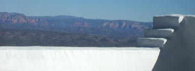
surreal,
extending downslope to Clarkdale (Clark's combo humanitarian-industrial founding), the Verde Valley, Sedona Cliffs, and Williams and San Francisco Peaks.

Upslope, lunch is at the Jerome Grand Hotel (a former hospital),

Bar,

looking out on the patio,

Valley,

and all the rest, again (now including the Powder Box Church -- now a private residence, and named for its construction utilizing old wooden boxes which once contained explosives).

Harriet buys me a new hat (much to the relief of some of my students), and we're out the door, back to Sedona.

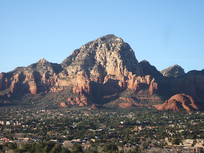
First stop, Lower and Upper Red Rocks Loop Road, since it's about time to take in the picture-book vistas of Courthouse Butte and

Cathedral Rock,

set among various

foregrounds (clearly, look, but don't touch).

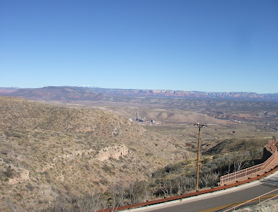
Dry Creek Road, the unique teal-arched planning-board-approved McDonalds, the adobe Safeway before Capitol Butte,

followed by Soldier (or Soldier's -- the first seems favored by a majority of guidebooks and maps, while the second is on the street signs) Pass's Coffee Pot Rock

evince the mixed blessings of development.

From here, we ascend halfway up Airport Mesa to the, shall we say, Vortex View of
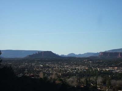
the Coxcomb,

Chimney Rock,
Capitol,

Sugarloaf,

Coffee,

Soldier,

The Sphinx, The Fin,

Wilson Mountain, and Steamboat Rock.

At the top of the Mesa, another stop --

are we viewed-out yet (with the Safeway down left from Capitol Rock and

the vista across the airport proper)?

Evidently not, because next is the beginning (but only the beginning, as the main course is unpaved) of Schnebly Hill Road, named after a founding pioneer in these parts, whose wife's given name was given to the town.

Here the world extends west to Mitten Ridge,

east to Munds Mountain,

and south back towards Capitol etc. And back towards there we head, to rendezvous with Roland and Liz at a local grill, for steaks and stir-fry and a far-inland fisherman's platter.