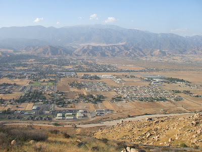
Up reasonably early, the Zanja Hills gleaming, to walk in the San Jacinto highlands.

But first, local national coffee

with John Browning (and friendly laughing woman adjacent -- terribly amused by her red Apple screen -- am told a regular denizen here and typical demeanor).

Then out into the world, with impressive clouds building up over Mt. San Bernardino.

On the road (I-10), related situation in the entire range

as well as the San Jacintos,

before turning in Banning toward the latter's foothills

and the peak area,

Route 243 knifing into the slopes,

up, up,

rising so steeply above San Gorgonio pass that the shift pops out of gear -- twice! -- and fears of major car trouble loom.

Burgermobile still seems basically sound, however, so press on to the intended trailhead at Marion Mountain Campground near an empty truck.

However, tropical moisture in the highlands still seems so extreme that gambling on a run to the top seems an unnecessary risk, so instead, decide to roadwalk below the trail (which needs doing at some point, anyway, since the intention is to take this northwest route, rather than the relatively less accessible northeast bona fide PCT as tao). The truck seems to approve.

So down the road we go, past huge boulders,

scattered clouds and pines (where the car key is temporarily misplaced...),

and an eccentric ranch,

connecting up with 243, what is styled on some maps as the continuation of the Palms to Pines Highway, with its crystlline road cuts.

From here, with views across to the route north ahead,

it's down to Dark Canyon of the San Jacinto River,

up to Lawler Lodge and

down again to Fuller Creek,

upslope to Black Mountain Road (Fools Peak and Mt. San Jacinto to right),

more boulders and views of the San Jacinto Highlands,

to Indian [Native American / Indigenous Person] Mountain,

and its nearer plateau viewpoint area,

with views west,

north,

and south, back to the San Jacinto massif.

There, that's enough -- John Browning, John Browning -- drive back with a boulder hill stop

by a crypt(ic) copse,

for views of Mt. San Gorgonio

and arid foothills of hairpin turns, casinos, and windmills.

Another stop, with a view ahead of the sinous descent,

the yaw of San Gorgonio Pass

from precipitous slopes,

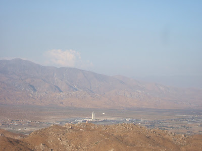
east to towering Cabazon Casino (there's no accounting....)

and too many windmills (ditto...),

west in the glare to the San Gabriels.

More stops, with peninsular views seemingly displaced from Joshua Tree,

the final descent, crosstown Banning,

back to Yucaipa for albondigas soup and Mexican coffee at Jose's

with a view of Zanja Peak / Crafton Hills over another eatery.
